Greetings, scholars!
In earlier reviews, most players said they were waiting for the full Jiuzhou map to go live. We know it ourselves: without the Jiuzhou map, the world of Huaxia: Warring States is incomplete. So we have been working on the full Jiuzhou map all this while, and we would like to share some of what we have been building.
This entry starts with the map's scale, the places on it, and a few of the design ideas behind them.
\[I. Setting Out from Yuzhou]
Until now, the open region was only Yuzhou. Places like Luoyi, Xinzheng, Daliang, Wancheng, and Chencheng are probably already familiar to you.
Now we have nine provinces and fifty-four commanderies, cities, county towns, rural settlements, passes, and other locations adding up to more than three hundred.
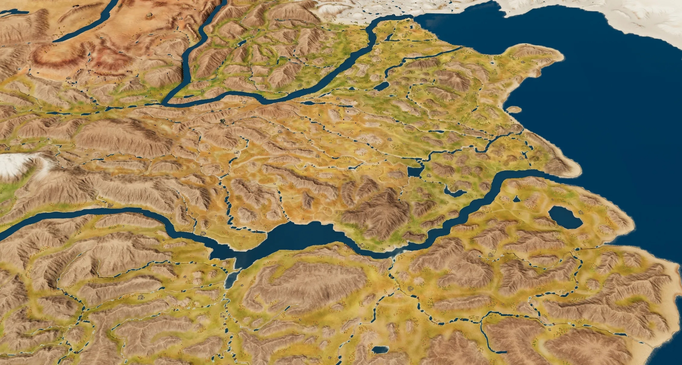 Xiangping in Liaodong to the north, Panyu in Lingnan to the south, Didao in Longxi to the west, Tancheng on the coast to the east—they finally appear on the same map.
This expansion is not only about making the map complete. It is also about the blank space between cities. How far apart two cities are, which small settlements sit along the road, where a pass goes and where a crossing goes—all of it decides what actually traveling the map feels like.
\[II. What's on the New Map]
Head west, and the first thing you run into is Hangu Pass.
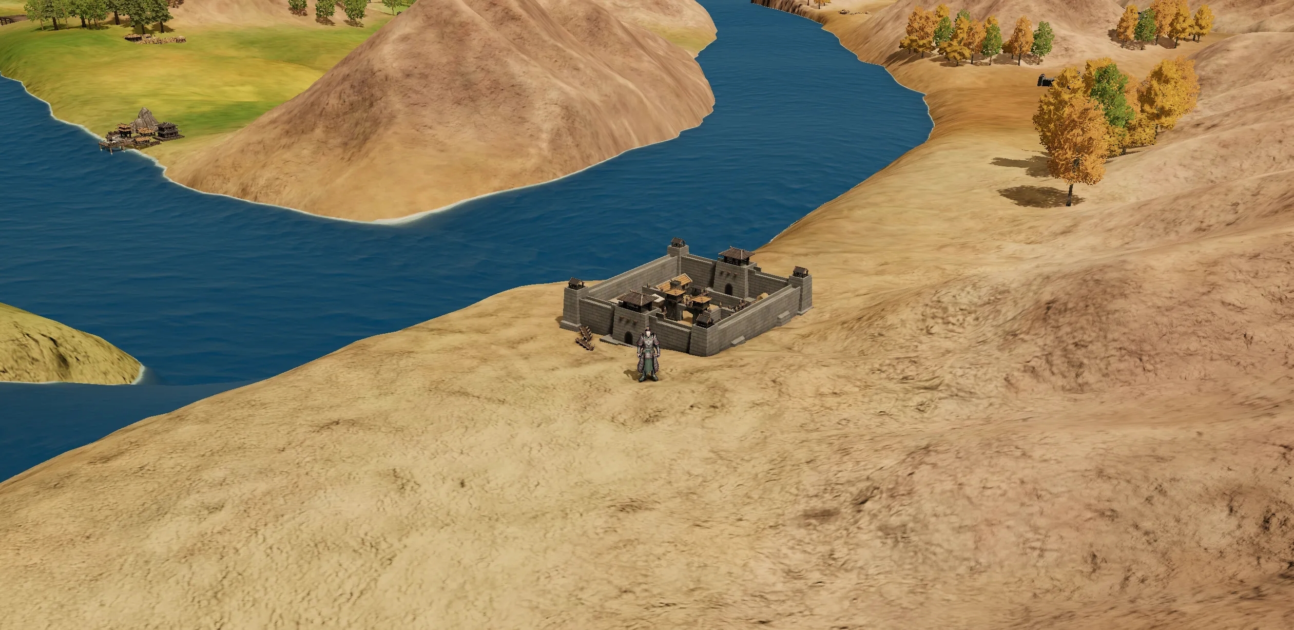 It is the only gate on Qin's eastern side. You either squeeze through that gate, or you go around to the Yellow River and look for a crossing—Mengjin, Xiaopingjin, Pubanjin, all of them waiting there. There are no bridges on the Yellow River and no shallows you can wade across, so a crossing is the only way over. Want to head south from Guanzhong into Chu? There is only one road, and it is called Wu Pass.
Head north, and the villages thin out while the rules loosen. Yunzhong Commandery holds the camp of the Loufan clan, Beidi Commandery holds the city of the Yiqu king, and Liaodong Commandery has a fortified settlement of its own.
Further south, at Lujiang and Nanhai, stand Hengpu Pass and Yangshan Pass. Those are the two doors leading from the Central Plains into Lingnan.
Cities are not all alike either. Daliang has a place called Shaohai, a trade site—a place for buying and selling. Wancheng has Fangzhu, where craftsmen gather. Chuiyi in Jiaodong is home to scholars.
There are new academies as well: the Legalists in Xihe Commandery, the Diplomats in Dai Commandery, the Agrarians in Nan Commandery, and the Mohists in Xincheng Commandery.
\[III. Commandery Cities, County Towns, and Rural Settlements]
We tried it—the earliest version had only two tiers: commandery cities and county towns. The result was that on the road from Luoyi to Daliang, the map had only a start and an end, with over two hundred li of blank space in between. Players had nothing to do but walk.
So we added a third tier. Every commandery now holds three kinds of places:
Commandery city: only one per commandery. Construction, garrisoning, production, and trade all happen here.
County town: goods come out here, and it can be upgraded and rebuilt. If you want to grow your power as an enfeoffed lord, this is the tier you start from.
Rural settlement: no administration, no people to govern, no taxes. It does one thing—produce resources, and resources are what make production possible and what keep a great army in the field.
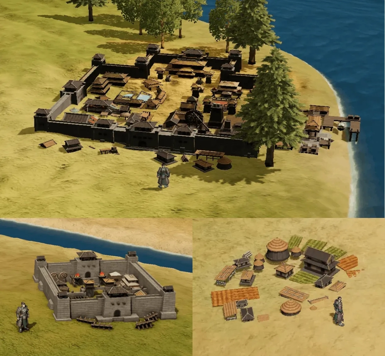 A rural settlement answers only to the commandery city, not to a county town, and later, when war comes, burning one rural settlement and burning one county town will not cost the same.
Smaller locations between cities sit mostly at the rural settlement tier, so you do not have to repeat a full set of county-town management and construction everywhere you stop. We want these places to fill out the road, but we also want to avoid adding numbers that all turn out the same.
\[IV. How Resources Are Distributed]
Resources currently fall into six categories: food, textiles, medicine, timber, stone, and minerals.
We made a distribution table for the provinces, using three levels to describe what each region has: 1 is scarce, 2 is sufficient, 3 is abundant.
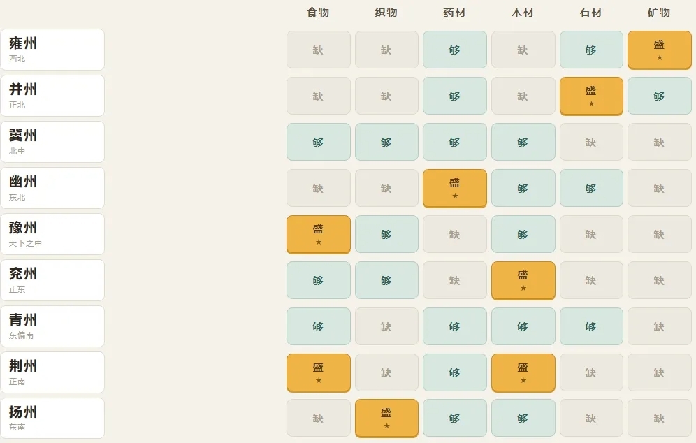 Under this version, every province is short of at least two categories. The top tier holds eight entries in all, spread across seven provinces.
Yongzhou leans toward minerals, Bingzhou toward stone, Youzhou toward medicine, and Yangzhou toward textiles. Jingzhou is rich in both food and timber, making it the only province with two top-tier resources. Jizhou and Qingzhou have none at all.
Interestingly, someone wrote a similar table two thousand years ago.
In the "Biographies of the Money-makers" in the Records of the Grand Historian, there is a passage that sorts the goods of the world by direction:
West of the mountains yields timber, bamboo, paper mulberry, hemp thread, yak tails, and jade; east of the mountains abounds in fish, salt, lacquer, silk, and music and women; south of the river produces nan-fir, catalpa, ginger, cassia, gold, tin, lead, cinnabar, rhinoceros horn, turtle shell, pearls, and ivory and hides; north of Longmen and Jieshi abounds in horses, cattle, sheep, felt and fur garments, sinew, and horn; copper and iron are found in mountains everywhere, scattered like pieces on a chessboard.
"West of the mountains yields jade"—west of the mountains means west of Mount Xiao, which is our Yongzhou, and we gave it a full mark in minerals.
"South of the river produces nan-fir and catalpa"—nan-fir and catalpa are both fine timber, and south of the river is Jingzhou, which we gave a full mark in timber.
"East of the mountains abounds in fish, salt, lacquer, and silk"—silk comes from east of Mount Xiao, which is the Central Plains and the east, so Yuzhou and Yanzhou get a 2 in textiles.
Why is Yongzhou's food a 1?
Guanzhong did later become the richest land under heaven, and that is true. But the canal that made it rich had not been dug yet.
The Zhengguo Canal was not begun until 246 BC. The man who oversaw the work, a hydraulic engineer of Han named Zheng Guo, was sent with the intent of "exhausting Qin"—to make Qin pour its money into waterworks and leave it too weak to fight. In the end the canal was finished, and Guanzhong became a granary.
Our year is 300 BC. The canal is still more than fifty years away. Before it, Guanzhong simply did not have enough grain—and that is the real reason a western state kept looking east.
Why can Jingzhou reach a full mark in timber?
There is a line in Mozi, spoken when Mozi tried to talk the King of Chu out of attacking Song:
Jing has tall pines, patterned catalpa, nanmu, and camphor; Song has no tall timber.
"Yuzhang" is the great camphor tree. Chu had all the pines, catalpa, nanmu, and camphor it wanted; Song did not have a single decent tree.
By the way, the word "Yuzhang" is on our place-name list—there is a place in Lujiang Commandery called Yuzhang.
Why does Yangzhou reach a full mark in textiles?
The southeast was the only high-yield cloth region in the world at the time. The Annals of Wu and Yue record that King Goujian of Yue, to thank the King of Wu, sent him a hundred thousand bolts of ko-hemp cloth in a single gift.
Cloth came out of the southeast and had to travel to the northwest to be traded for iron, crossing the entire Central Plains on the way.
Why does Bingzhou reach a full mark in stone?
Open the map and look at Bingzhou: five commanderies, and all five are frontier commanderies. This stretch is the Shanxi Plateau and the Ordos loop—mountains at your door, stone overhead.
Zhao's northern wall was built along the Yanmen and Yunzhong line. Building a wall takes stone, and stone is taken from what lies nearby. For this region, stone is not a resource—it is a necessity.
Why does Youzhou reach a full mark in medicine?
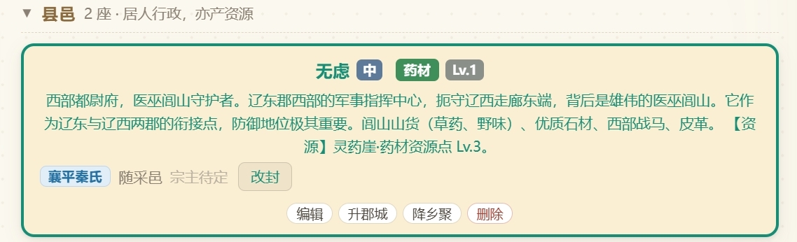
In the far west of Youzhou is Wulü County, backed by the Yiwulü Mountains. In this part of the world, those mountains mean one thing: mountain produce. The five commanderies north of Yan could hardly grow grain, and whatever could be traded for money lay in the hills.
So the roads built themselves
We did not build a "trade route" system. We simply made sure that what each place has plenty of is different—caravans will wear the roads in on their own.
\[V. Passes and Crossings]
The map currently holds fourteen passes, six fortresses, and more than thirty crossings. These places mainly affect the routes you can take.
Want to enter Guanzhong? Hangu Pass, or one of the crossings on the Yellow River.
Want to cross the mountains south from Shangdang? Huguan Pass and Changping Pass.
Want to go northeast from the Yan capital to Liaodong? A chain of them: Juyong Pass → Lingci Fortress → Tashi Ferry.
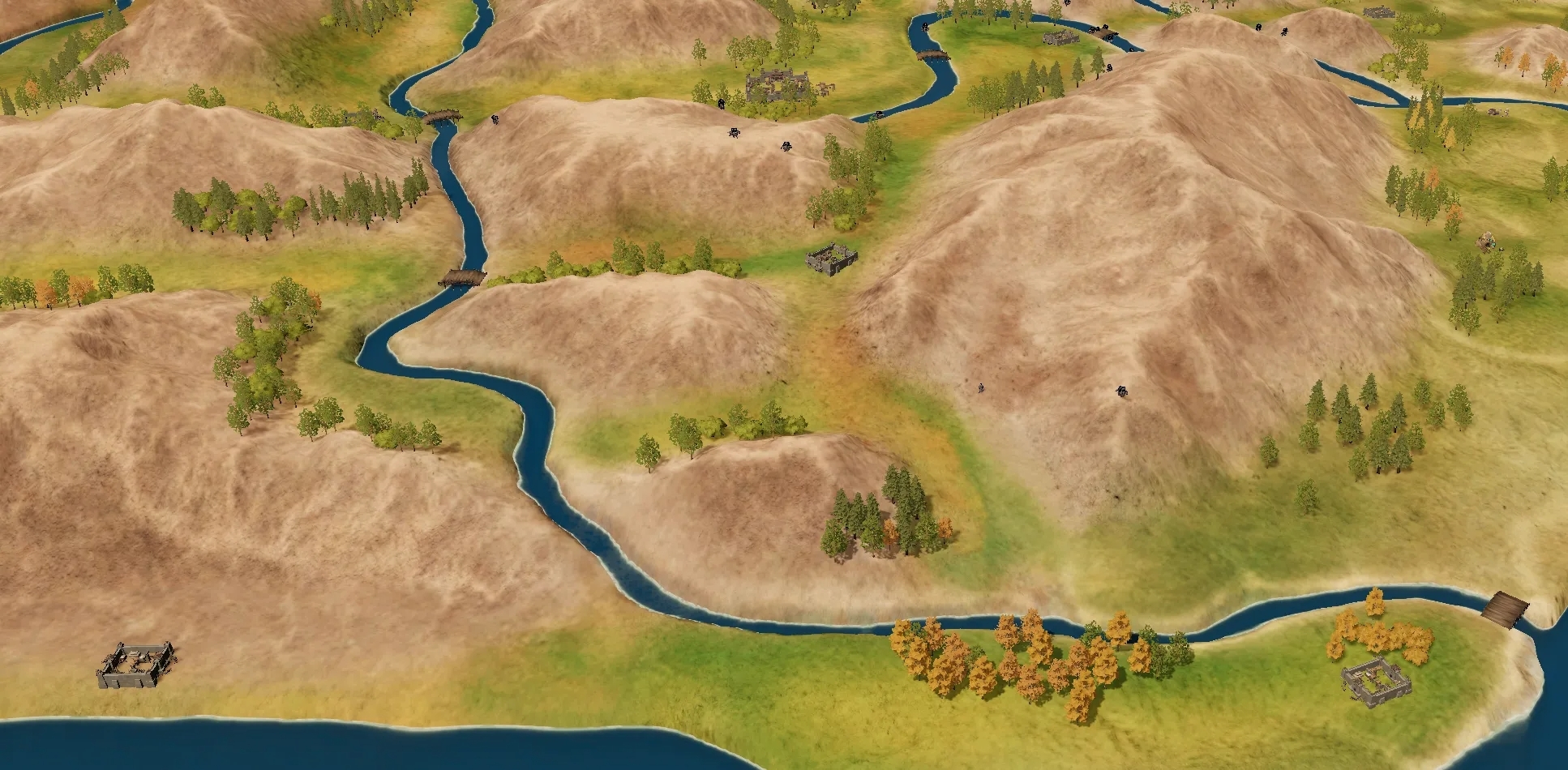 Some of these routes sit on the border between two states, so they affect not only travel distance but the ties between two regions. We want marching and trading to offer some real choices: which crossing to take, which pass to go through, and whether another way exists once one of them is blocked.
\[VI. Place Names and Historical Context]
The game is set in 300 BC. Beyond the seven states, we have also kept place names and power arrangements connected to Zhou, Lu, Zhongshan, Yiqu, and Wei.
There is a difference in perspective here, and it needs to be said plainly: to those of us looking back, these states "have not yet died"; to someone living in 300 BC, they are simply "still alive."
The connections between Luoyi and Zhou, between the city of Lu and Lu, between the Dongyuan area and Zhongshan, between the city of Yiqu and Yiqu—we want to keep them in the game. Wei is handled separately, as a vassal.
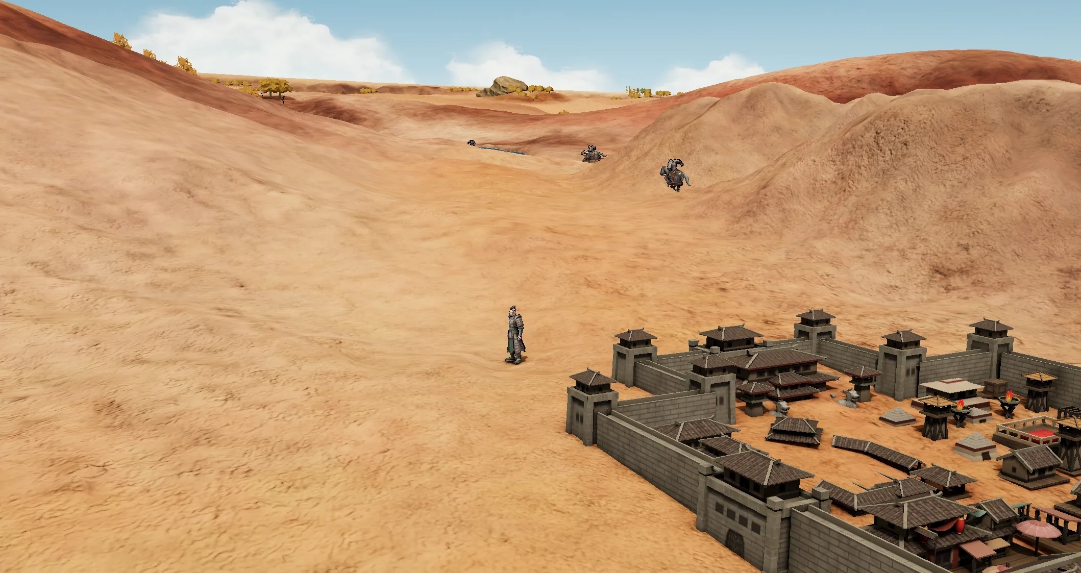 Behind these names lie small states and local powers beyond the seven states. We want to keep their own origins rather than treating every town on the map as the same kind of thing.
\[VII. What's Next]
This entry has laid out the overall plan for the Jiuzhou map. Later entries will go region by region through specific places and content, and the next one heads west from Hangu Pass to talk about Guanzhong.
Thank you, scholars, for reading—and thank you to everyone who left specific questions and suggestions before.